Discovering the Boyne : Green Way
Perhaps, because it is the home of so much history and heritage we can sometimes forget that the valley of the River Boyne is an astonishingly beautiful garden landscape and truly a land not just of a thousand welcomes, but most definitely, of a thousand greens. The walks and walkways outlined here give you and your family a chance to discover this enchanting and endearing countryside; and maybe to come to understand a little of our past, in a safe secure adventure.
The GreenWay…
Summary : Treat this as a whole day adventure: Arrive in Drogheda, and take the riverside path to the gates of the Oldbridge Estate, and on to the Visitor Centre. Discover the story of the Battle of the Boyne, something of the gardens and horticultural practices of the estate, take lunch in the café facilities there and then follow the route of the Towpath Walk, GreenHills Walk and Groggins Field Walk to join a small tarmac bohereen heading back toward the river (N) Rejoin the GreenWay and enjoy an easy ambling return to Drogheda. And so discover the landscape of the battle and flora and fauna that inhabit it now.
Walking facts …
Difficulty: Easy bordering on moderate because of the distance only.( 1.5 on a scale of 1 to 5).
Mostly flat, mostly wide tracks, some meadow paths.
Hazards: Much of the way runs along the bank of the river Boyne or it’s navigation canals. Exercise common sense and alert children.
Distance: 12 or so kilometres, (7.5 miles) return from Drogheda to Oldbridge and around the estate walkways.
To and from Drogheda to the Oldbridge Estate gates, just along the river bank, 8 kilometres (5 miles) return.
Time: Allow 4 hours at an easy pace. Plus any time you spend in the visitor centre, café, gardens, wandering the Parklands (other than the route) or having a picnic just dawdling along the way. Power walking to the estate gates and back: 75 minutes.
Maps: OSI 1:50000 Discovery Series No. 43, DUBLIN, LOUTH, MEATH.
There is also an OPW leaflet of the parkland and it’s walkways which is free from the Visitor Centre.
Links: Office of Public Works Battle of the Boyne and Oldbridge Estate web site: http://battleoftheboyne.ie
Brief description: The route mostly follows the right bank of the River Boyne with the addition of some meadow walking. There is abundant flora and fauna; a horticultural heritage experience, and a 17th century battleground exploration.
Instructions:The walks starts at the footbridge over the Boyne in Drogheda. Instructions for getting to the start of the walk can be found lower down the page under “Getting there…”
The Route …

Map copyright: Google Maps 2014. Annotation copyright David Marshall 2014
1 : The Boyne Footbridge
Find your way to the footbridge over the River Boyne in Drogheda, either follow the instructions in the Getting there section below or ask anyone in the town for directions. It’s not hard to find.
Starting : Make sure you are on the south bank of the river. (That’s the right true bank, and the opposite side of most of the town).
Head off generally Westwards up and then down the pedestrian ramp to arrive below the St Georges Street road bridge directly ahead of you.
2 : The Georges St. bridge
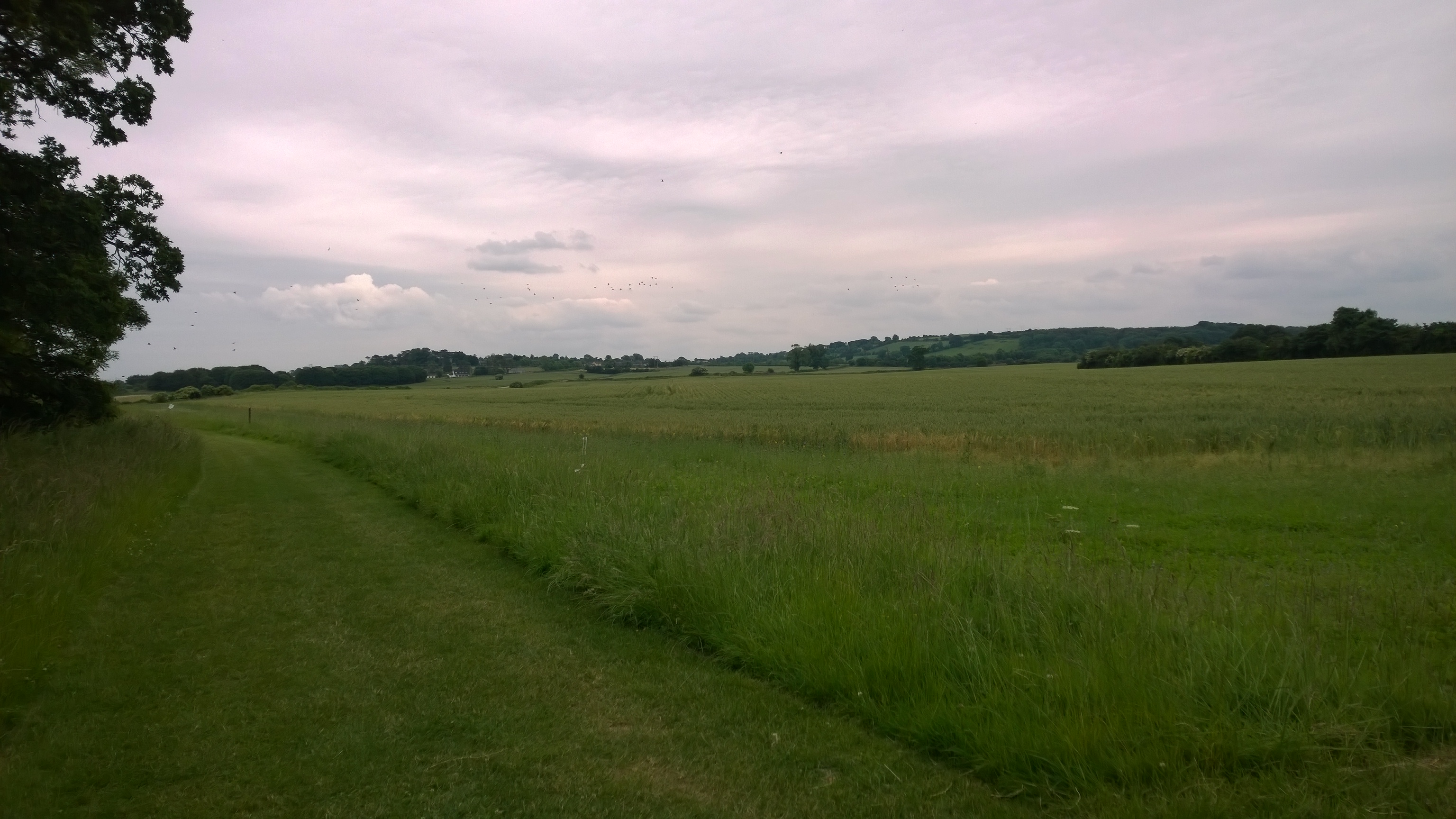
Staying by the river, pass under the bridge and follow the wide “GreenWay” as it tracks the river’s right bank Westwards.
Rising at TrinityWell in Kildare, some 50 kilometers or so West of Dublin. It flows in an arc first North then East through Trim and the wider County Meath to reach the Irish Sea beyond Drogheda in Louth; just 112 kilometers from it’s source.Like the Liffey, its short course belies it’s significance in our history and heritage, in our mythology and our story telling. Just ask any fisherman to tell you the size of the salmon or the trout he last caught there; for the story of the river’s creation by Bóinn, her eventual destruction by the floods she created and the other doings of the Tuatha Dé Danann are much too long and with as many twists and turns as the Boyne itself, for the recounting here.

The Boyne
3 : Rathmullan Road
Stay with the obvious GreenWay as it reaches the minor Rathmullan Road. It will keep company with you now until you reach the Oldbridge Estate. I am told it’s never very busy but it pays to be aware.
4 : The Mary Mcaleese Bridge (M1)
Pass under the M1 motorway, perhaps noticing how quiet it is directly under the Mary Mcaleese Bridge. And continue alongside the canalised bank of the river until the Rathmullen road makes an abrupt turn right in front of you, in order to cross the canal. Stop and leave the path, to cross the road with care and walk towards the stone & iron gated entrance of the Oldbridge Estate.
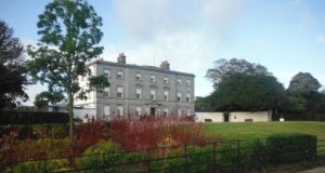
- Oldbrige House : Copyright 2014 OPW

5 : Gated entrance – Oldbridge Estate
Follow the grand tarmac driveway to find a gate in the fence on the left: Pass the lodge on your left, and through the gates toward the great house (Oldbridge) ahead of you. (Still walking Westwards). There is a black cast iron sheep/deer fence on your left. After a short distance you will see a gate in the fence. You may pass through this and pick up a line of yellow capped waymarks heading to the left of Oldbridge House. This marked walkway is known as The Oldbridge Village Walk and you may stride out across the parkland in confident knowledge that you are not trespassing.
6 : The Visitor Centre
Arrive in front of Oldbridge House.
The estate is now the property of the Office of Public Works. The house itself offers an informative, and entertaining presentation of the Battle of the Boyne. It sets it in the context of the European political scene at the time; shows the technology of the battle, the costumes and customs; the nature of the battle and the outcomes for Ireland, Britain and Europe. There is an especially engaging “laser” light display of the course and progress of the battle; and a separate film illustrating the action. Outside in the gated courtyard are the building and tools associated with the life of the estate in the nineteenth and twentieth centuries.
To continue with the walk : Leave Oldbridge House choosing any route that suits, to head back towards the entrance gates you passed through earlier. Go through the gates and turn left (N) onto the road and pass over the road bridge which crosses the canal. Immediately over the canal the road makes a sharp left, (NW), stay with it for 250 metres.
Start of the canal tow path, as seen from the road
7 : Follow the canal towpath
The road then rises and turns to the right to cross the River Boyne at the Obelisk Bridge. You, however…
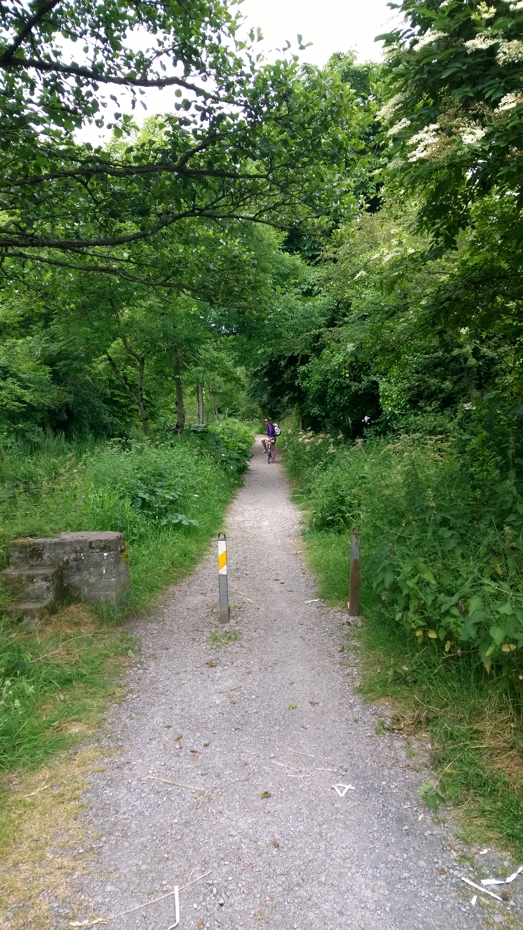
Keep left and stay with the canal and it’s towpath, heading West. Look for this path, in the photo on the left. The canal is immediately to the left of it and the river off to the right.
Enjoy this easy path trodden by countless hooves before you, until you reach this bridge which carries the path over the canal to the other bank. Cross the bridge and continue on for another 250 metres alongside the overgrown canal, until you reach a clear path junction with an assembly of gates on your left.

Follow the towpath over the canal by this bridge
8 : Leave the canal/river bank
Now turn left (Roughly E) leave the canal bank and go through the iron and steel kissing gate, directly ahead of you on the left. Once through the gate, you may see a walkway information panel which will confirm you are on the right route.
Do not go ahead up the steep bank, but turn left (NE) and follow the incline to arrive on the top of the ridge between two banks of trees…
… and onto one of the key landscape heights of the Battle of the Boyne. This ridge was occupied by the Jacobite army on 1st July 1690 (11 July by our modern Gregorian calendar).

The wide Green Hills walkway and The Bird Hut
9 : Near the bird hut
Advance straight ahead, between the trees (NE) to the end. Turn right (SE) to join The Greenhills Walk and come upon a large box like hide: The Bird Hut. Continue along the wide way, through a zigzag to arrive at a green open path junction. (From here you may turn left and descend Crab Apple Walk to return to the stone lodge and iron gated entrance of the estate. Point 6 on the map above)
It is from this ridge, to the foot of the slopes below, that the Jacobite cavalry made multiple charges to try to defeat the guards of the Williamites who had successfully crossed the river and now challenged the dethroned James II of England.

360 degree “daisy” panorama on the slopes below the path junction
10 : Groggins Field Walk & bohereen
Stay on the ridge continuing SE along Croggin’s Field Walk following the pronounced left and right turn to arrive at a tarmac bohereen beyond which lies Croggin’s Field. Turn left (NNE) onto the asphalt and descend the hill towards the Boyne.
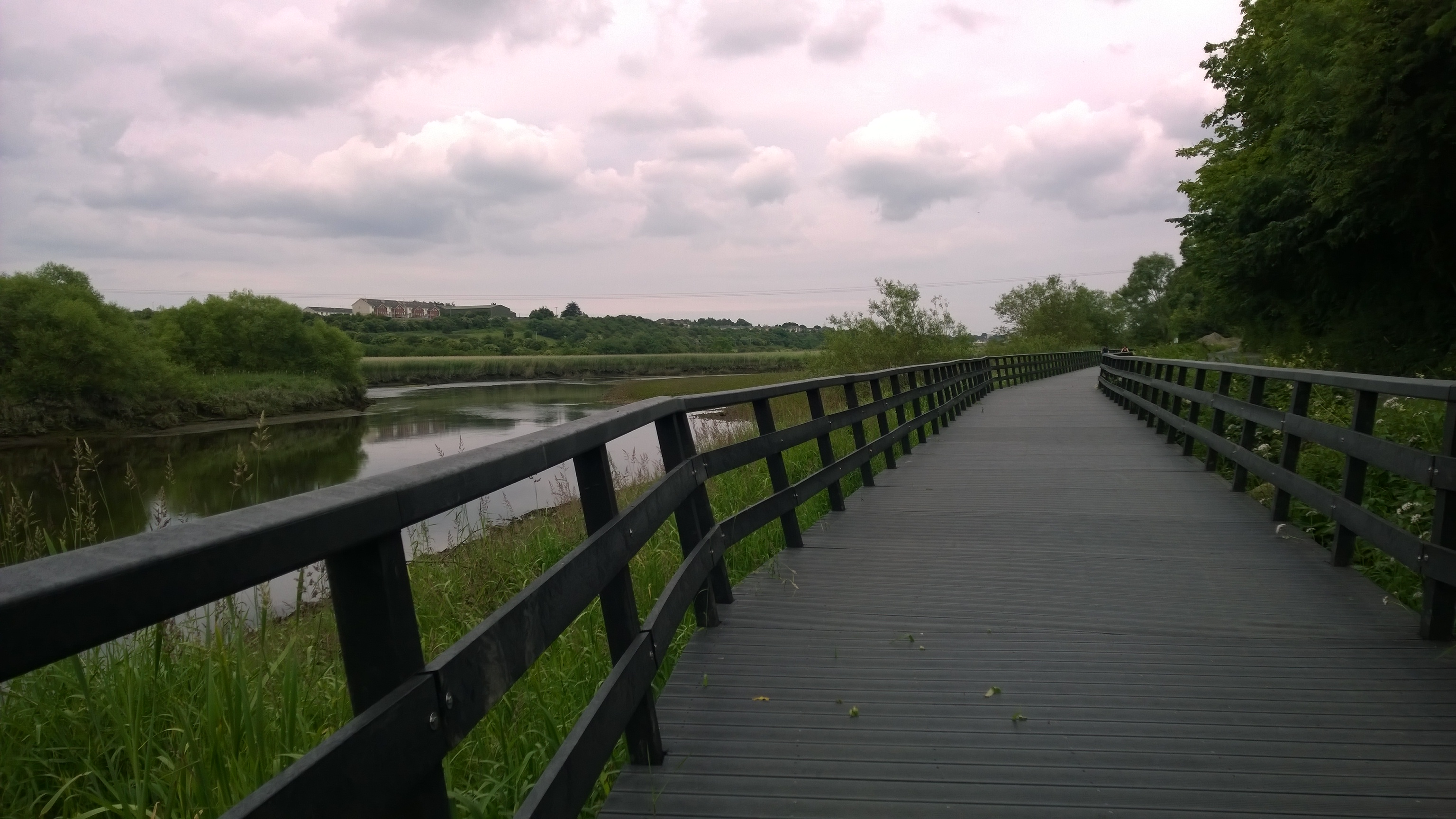
The Green Way boardwalk back to Drogheda
11 : Rejoin the Boyne GreenWay & head home
As you reach the foot of the hill and the tarmac T-junction, you will recognise the location from earlier in your day. Turn right (SE) and regain your tread along the wide Green Way back to Drogheda agus slán abhaile.
Getting there
You can arrive on the fringe of Drogheda:
- By Bus Eireann to the terminus close by the corner of Donore Road and George’s Street
- By Irish Rail to the station of the Dublin Road
- Or by car, perhaps parking off Old Abbey Lane. Be warned Drogheda can be very congested during the day, weekends and weekdays.

Map copyright: Google Maps 2014. Annotation copyright David Marshall 2014
Getting to the START
A : From the Railway station: Exit the station by the main entrance. Follow the access road downhill and turn right (NW) onto the Dublin Road (R132). Now walk for 1200 metres (The road will change it’s name a few times as you pass along it), past two road bridges crossing until you reach a long ramp running down toward a footbridge over the river. Do not cross the bridge, but follow the route instructions from this point.
B : From the bus terminus : Exit the bus terminus onto the Donore road and turn left downhill toward the river and the Rathmullan Road. Cross the road at any point where it is safe to do so. And turn left (WNW) along the Rathmullen road to pick up a long ramp running down toward a footbridge over the river. Do not cross the bridge, but follow the route instructions from this point.
C : From the car park shown : Exit the car park (Eastwards) through the entrance at the bend on Connolly Way. Carry straight ahead SE) to arrive at the start of Wellington Quay and on your right a footbridge over the river. Turn right and cross the bridge. Once over the bridge turn right onto the rising pedestrian ramp and follow the route instructions from this point.
Have I earned your “Like”?
If you find this information entertaining or useful I’d really appreciate your Facebook “Like”. You can click on the Facebook button near the top right of this page or or visit my Facebook Page: Walking With David. Thank you.
Ramblers’ know-how : Naming the banks of a river.
I mention that in this walk you will walk along the right bank of the river. It doesn’t matter whether you are walking away from Drogheda to Oldbridge, with the river on your right; or if you are walking away from Oldbridge toward Drogheda with the river on your left; I still call it the right bank of the river. Why is that?
Think of it this way. It’s customary when working out which is the left and which is the right bank of a river, to imagine that you are standing with your back toward the source of the river; the place it is flowing from. So, if you stood astride the river, a brook or a stream, it would be running from behind you, through you legs, and away ahead of you. Imagine you are doing that now, astride the Boyne, with you back toward’s Oldbridge and the river source, and your face toward Drogheda. The bank of the North side of the river would be the left bank, (your left) and the bank on the South side of the river would be the right bank (your right). Get it.
Sometimes, to be absolutely clear this is what they mean, writers and guides will call it the true left or true right bank of the river.
Questions or Comments
By all means ask a question about the route or the walk generally, or let us know what you thought if you’ve walked it…


Glad I found your site, very informative! This seems like a peaceful walk, a great place to do some “thinking.”
LikeLike
Hi David,
Delighted to find your blog.
As a Navan man, I’m disappointed that your Boyne walk stopped so far away from us, but I trust you will return 😉
One of the most beautiful (and easy) walks is from the Bridge of the Boyne at Stackallen (near Wiggers Cross) to the Ramparts of Navan. It’s approximately 5 miles, or a 10-mile round-trip if you park the car at either end (there are car-parks in both spots). Its tranquility makes it so beautiful and a haven for birds – my most recent walk there (back in January, sadly), I saw herons, buzzards, ravens, moorhens by the dozen, a couple of kingfishers (that most pleasing of sights – a flash of blue and orange) and a little egret. It was as satisfying a couple of hours of solitude as I’ve had in ages.
Anyway, happy walking…
Shane
LikeLike
Hi Shane
Thanks for the comment… and so sorry to have disappointed you. Actually I did fire off a few emails (about 7) to three local authorities and tourist agencies seeking connections and info, for precisely that objective. And didn’t even get the courtesy of a “sorry can’t help”.
The route you describe sounds lovely… for the Kingfishers alone… as you may know large portions of the population die in January and February… the egret is still a relative newcomer and the buzzards are clearly expanding away from their sweet spots on the east coast and in the north.
I would like to sort some kind of walk in the area you describe. Even better would be something circular and supported by public transport. Maybe I’ll have another go …
Thanks again for your thoughts. It’s very much appreciated.
D.
LikeLike
Hi David,
Ah not disappointed at all – I always love to see content focusing on local stuff.
The Navan-Stackallen walk can be made circular by coming back via Slane-Navan road or even better Boyne Road. But I always find the return walk back along the river just as good, as you’re seeing everything from different angles – there are several bends in the river, old ruins (including the remains of what I seem to recall is a 12th century bridge over the Boyne) and impressive old Ardmulchan House (which would make a great setting if ever they decided to do an Irish-set remake of The Omen!)
Your experience from local authority doesn’t surprise me. I had the audacity to attend a job interview with a tourist authority a number of years ago and the lack of energy from the interview board was soul-destroying. It felt like either they didn’t believe in the product (which is insane) or they were so weighed down by bureacracy that they just couldn’t muster the interest. I didn’t get offered the job; maybe I got out of jail, but attracting people to the Boyne Valley should not be a problem. We have some of the most amazing treasures in the world, but we don’t cater for tourists/visitors very well.
All the best,
Shane
LikeLike